- 1 · The tower
- 2 · The plan
- 3 · Three years on
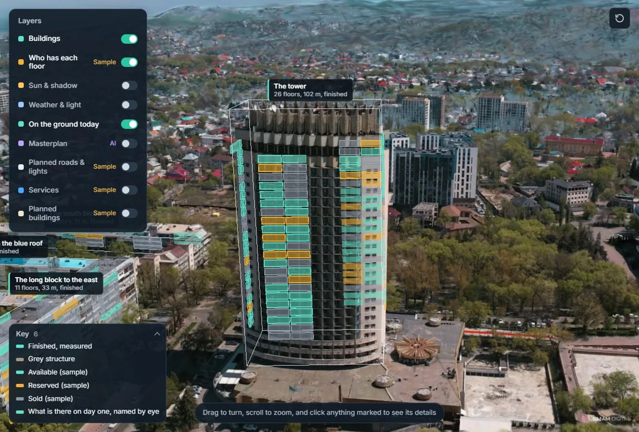
A crowned 1970s tower in central Almaty, with the city round it and the mountains behind, rebuilt in 3D from seven stock drone clips flown near and far. The tower is measured from the 3D and opened up as sample residences: every home sits on its floor and its side of the building, available, reserved or sold, with its size, its view (the mountains or the city) and a price in tenge, in a register you can filter and export. Five apartment blocks round it are measured the same way, with sample resale flats on their floors. Round them, a sample plan for the district is laid on the real streets, traced on a straight-down view of the 3D: two 12-floor towers rising in the sunken courts, the square turned into a park, a garden walk, the avenue as a tree-lined boulevard, and the water, sewer, power and gas under the streets, each built month by month on the timeline. From the drone's own view, a slider compares today's 3D with AI pictures of the same view a year and three years on. The side panel sets it against the city's own programmes: the average new-build price, the 7-20-25 mortgage, the renovation programme to 2030 and the height limits in the centre, each checked against two published sources. Phases plays the plan month by month: the new towers rise as concrete frames with cranes, take their cladding, and the square fills with trees. The tower itself is read frame by frame by AI from 16 drone frames (its concrete walls, the grid of loggias, the crown of metal fins, its condition), each reading shown with the frame that gave it and how many frames agree, beside guides measured on the 3D. Green cover is mapped from colour and height on the 3D, 95 vehicles are counted from the frames, and a floor slider stands you outside any floor of the tower to look out, with real drone photos of the mountains at the top.
What we measured
| Measure | Result | Note |
|---|---|---|
| Footage | 393 frames | Seven stock drone clips, near and far, all placed in one 3D |
| 3D rebuild | 29.9 dB | Checked against every 8th frame, which the 3D was not built from |
| Homes | 347 | 134 in the tower and 213 in five blocks round it, all samples |
| Scale | ±15% | From the tower's published height |
| Tower reading | 16 frames | AI answers kept only where most frames agree; for an engineer to confirm |
| Tree canopy | 22% | Of the ground within 220 m, from colour and height on the 3D: a guide |
What went wrong
- The tower's first outline was 41 by 35 m and turned 45 degrees: the measurement trimmed the ends of its lens-shaped plan. Measured again on the shaft alone, it is 54 by 34 m on its true axis.
- The far city sat further out than the viewer draws, so a dark band showed above the horizon. It is pulled in, with a hazy sky behind.
- The first plan was cast from one oblique drone frame onto a flat ground, and its boulevard and side street missed the real roads. Everything was traced again on a straight-down view of the 3D.
What happens next
- The view from your floor: the real drone frame taken nearest each floor's height and direction.