- 1 · The footage
- 2 · Into 3D
- 3 · Land use
- 4 · Found
- 5 · Could do
- 6 · Before and after
- 7 · The estate
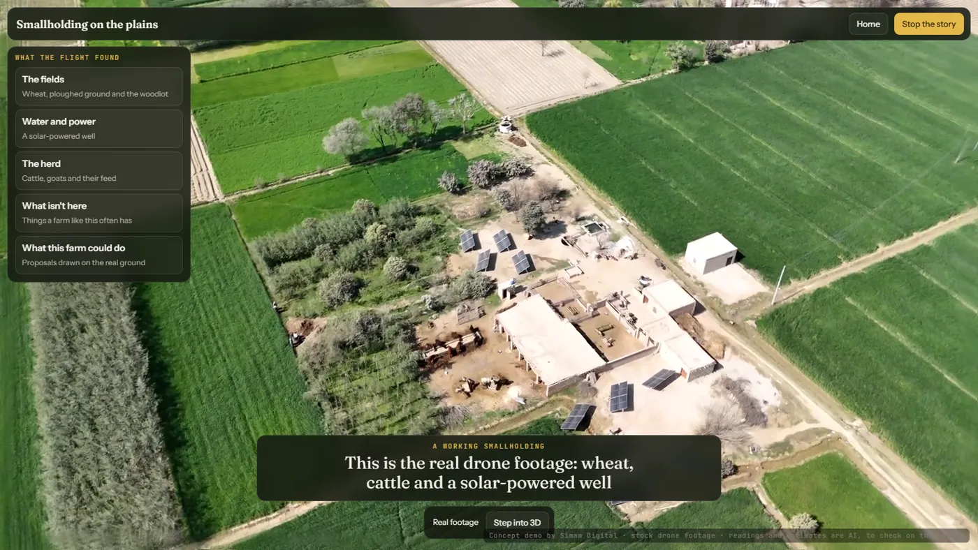
Most farmland at home is grass and fields, and most farms have never been measured from the air. We took short stock drone clips of three very different farms, an English-style equestrian estate and two farms on Asian plains, and read each one from the footage itself. Each tour opens on the real drone footage and turns into a measured 3D farm in about three seconds, then tells the story: the fields and how big they are, how water reaches them, the animals and buildings, what isn't there, and what the farm could do. On the smallholding the proposals are drawn on the real ground with their numbers, a green fodder plot on a ploughed field, laser-levelled basins on the main wheat field and a storage pond by the well, each with a before and after picture. On the estate, the main paddock is split into grazing cells and the stable roof is sized for solar.
What we measured
| Measure | Result | Note |
|---|---|---|
| Farms | 3 | An English-style estate and two farms on Asian plains, one short stock drone flight each |
| Footage to 3D | ~3 s | Each tour opens on the real footage, then turns into the scan |
| Smallholding mapped | 16.8 ha | 11.5 ha green crop, 2.1 ha ploughed, 2.4 ha trees (±25%) |
| Proposals with numbers | 5 | Smallholding: fodder plot 0.79 ha, levelling about 1.5 t more wheat a season, pond about 900 m³ · Estate: paddock in three grazing cells, roughly 190 kW of roof solar |
What happens next
- A real farm's own flight, with a measured object or GPS for an exact scale.
- Paddock, fence and roof measurements for grass and livestock farms at home.